
Contents of this article
- 1. Trench arc basin system
- 2. Discussion records of several important issues in the development and evolution of geological structures
- 3. What mineral resources are rich in southern Anhui?
trench arc basin system
2.2.1 Division of geotectonic units
This book divides the geotectonic units in this area based on the mutual transformation relationship between the oceanic and continental lithospheric tectonic evolution systems in the plate tectonics theory. In the oceanic tectonic system, tectonic units such as plate binding zones and residual intraoceanic island arc zones are divided. The continental tectonic system is divided into structural units such as continental blocks, continental margin arcs, continental margin island arcs, back-arc basins, foreland basins, strike-slip pull-apart basins, forearc basins and extensional basins.
The detailed division of geotectonic units is shown in Figure 2.2. It is obvious that all structural units in the area are distributed along the north-northwest main structural line. The structure and sedimentation characteristics of each unit are briefly analyzed from east to west as follows.
2.2.1.1 Jinshajiang junction zone
The Jinsha River junction zone extends from Dengke to Yushu in the west to the Yanghu and Guozhacuo areas in northern Tibet; it passes south through Batang, Derong, Benzilan, and the west side of Diancang Mountain, and then turns southeast through Ai Laoshan extends beyond the country's borders. The study area is located in the middle section, that is, the Dengke-Batang area.
Many scholars have conducted research on this belt to varying degrees (Liu Chaoji, 1980; Liu Zengqian et al., 1983; Chen Bingwei, 1983; Pan Guitang, 1983; Zhang Qi et al., 1988, 1992; Li Xingzhen et al., 1991; Luo Jianning et al., 1992; Mo Xuanxue et al., 1993; Liu Zengqian, Li Xingzhen et al., 1993; Zhang Yifu, Zheng Jianjiang, 1994; Chen Zhiliang et al., 1995; Pan Guitang et al., 1997, etc.). Within the zone, structural mixed blocks such as basic and ultrabasic rocks, carbonate rocks, slates and siliceous rocks can be seen everywhere (Luo Jianning et al., 1992); the age of the rock blocks ranges from Devonian to Permian, and the matrix is Permian- Triassic flysch sandstone, slate, radiolarian siliceous rock and basic and medium-acidic volcanic rocks. The ophiolite in the Batang-Xiaruo area is mainly composed of serpentinized ultramafic rock, ultramafic rock, gabbro, diabase wall group, ridge-type basalt and radiolarian siliceous rock, and other The dismembered Devonian, Carboniferous, and Permian limestones and their basal greenschists constitute the ophiolite melange belt. Among them, the ophiolite sections in Derong and Xumai areas are relatively complete, and plagioclase granite emplacement was found (Xu Tongrui, 1995). The ultramafic rocks in this zone mostly have M/F ratios of 6.95 to 11.0, and their rare earth and trace element geochemistry are close to the original mantle spinel lherzolite. The petrochemistry of oceanic ridge and quasi-oceanic ridge basalts is characterized by low K2O and low TiO2, and their total rare earth content ΣREE is low (43.7×10⁻⁶ and 39.6×10⁻⁶), the partitioning patterns range from weak depletion to weak enrichment of LREE, almost flat type respectively (Mo Xuanxue et al., 1993). The formation age of the ophiolite in this zone is mainly determined to be the Early Carboniferous based on the radiolarian siliceous rocks that coexist with the ridge-type basalt, and may extend to the Late Devonian or earlier (Li Xingzhen, 1991; Pan Guitang, 1997), but It will not be earlier than the Devonian (Pan Guitang et al., 1997). The oldest radiolarian fossils include Entactinia sp., Entactinosphera sp. (D3), Entactinia parva won, E.torispina ormistonet Lane, etc., which are obviously from the Late Devonian to the Early Carboniferous. Most siliceous rocks have weak Ce anomalies, while iron- and manganese-rich siliceous rocks have positive anomalies. In the tectonic evolution, the Jinshajiang Ocean began to subduct southward and westward at the end of the Early Permian (P1), and formed an intra-oceanic area in the Xilianghe-Dongzhucun area of the southern section of the Jinshajiang River on its west side. Initial arc (Liu Zengqian, Li Xingzhen et al., 1993; Mo Xuanxue et al., 1993). The closing time may be the Middle Triassic, which varies in different areas (Pan Guitang et al., 1997). Because it is easy to observe that the Upper Triassic in this belt is angularly unconformably overlaid on the ophiolite melange belt, or that the conglomerates at the bottom contain ophiolite gravels. At the same time, in the early Late Triassic, in some sections of the original island arc belt, such as the Jiangda continental margin island arc, a set of calc-alkaline series of lagging volcanic rocks still developed after molasse deposition (Mo Xuanxue et al., 1993). Even on microcontinental blocks, such as the Qamdo microcontinental block, the Upper Triassic can be seen angularly unconformably overlying the Middle Triassic. Therefore, the impact of this collisional orogeny was very far-reaching and widespread. In Figure 2.3, the Jinsha River belt shows good magnetic anomalies with positive and negative arrangements. It also shows northwest differentiation in the Bouguer gravity anomaly map (Figure 2.4) and the Moho contour map (Figure 2.5). .
Figure 2.2 Geotectonic unit map of Qamdo area
2.2.1.2 Jiangda-Azhong-Mangco continental margin arc and intra-arc basin
This arc is located to the west of the Jinsha River junction zone, bounded by the Chesuo Township-Deqin Fault in the west, and extends southward to Weixi in Yunnan. This zone is the northern section of the Jiangda-Weixi-Luchun late Paleozoic-early Mesozoic continental margin arc (Luo Jianning et al., 1995). The exposed strata are Paleozoic to Upper Triassic. Four stages can be divided: stage one is composed of pre-Devonian gneiss, schist and metamorphic intermediate-basic volcanic rocks; stage two is composed of Upper Paleozoic clastic rocks and limestone intercalated with intermediate-basic volcanic rocks; stage three is early It is composed of Middle Triassic sedimentary rocks and medium-acidic volcanic rocks; the fourth stage is Late Triassic clastic rocks and lagging arc volcanic rocks, with coal lines or coal seams in the upper part. Except for the angular unconformable contact between stage 2 and stage 3, and between stage 3 and stage 4, all other layers are in conformable contact. Symbiotic with the volcanic arc, there are also I-type granite batholiths or rock strains distributed along the north-northwest direction (Liu Zhensheng et al., 1994; Wang Zeng et al., 1995).
Figure 2.3 Schematic diagram of magnetic field divisions in the eastern Tibet-western Sichuan region
2.2.1.3 Shengda residual back-arc basin
The basin borders the Jiangda continental margin arc to the east and the Changdu microcontinent to the west. It is a residual back-arc basin with continental crust as its base. In the center of the basin, there is a basin composed of Proterozoic metamorphic rocks and Hercynian granite bodies. Underwater uplift (Peng Yongmin et al., 1999), where deposits of terrigenous, endogenous and volcanic turbidite deposits with a thickness greater than 5000 m in the lower deep water phase of the Late Triassic and characteristic back-arc extensional alkali basalt and seafloor vent hot water deposits, as well as clastic rocks and carbonate rock deposits in the upper shallow marine facies. This set of thick sedimentary rocks is built on a folded soft basement of the Late Paleozoic. The current basin is covered by the Upper Triassic unconformably on old strata of different eras. The underlying Middle Triassic and the overlying Jurassic and post-Jurassic strata are not exposed in the basin area, and are only seen at the edge of the basin. It is equivalent to the Lower Triassic Marathon Formation deposited in the early Indian Stage. The latter is mainly composed of lower clastic rocks intercalated with limestone and upper rhyolitic volcanic rocks.
2.2.1.4 Qamdo microcontinent and craton basin
This belt is bounded by the residual back-arc basin to the east and adjacent to the Jitang-Dongdashan collision volcanic rock belt to the west. The exposed strata are Ordovician-Tertiary, which can be divided into five stages (Luo Jianning et al., 1992). Stage 1 consists of Lower Paleozoic flysch sandstone and slate intercalated with carbonate rocks, with a thickness greater than 3615 m. Stage 2 is Devonian to Lower Permian continental to shallow marine carbonate rocks and clastic rocks intercalated with a small amount of volcanic material, and is about 2500 m thick. There is unconformable contact between stage one and stage two. Stage three is the accumulation of Upper Permian coal-bearing clastic rocks, Lower and Middle Triassic sedimentary rocks and intermediate-acidic volcanic rocks, with a thickness of 3000 m. Stage 4 is the late Triassic and later continental to littoral shallow marine red coarse-grained clastic rocks intercalated with carbonate rocks and volcanic rocks, nearly 10,000 meters thick. Stage five consists of Tertiary red clastic rocks, coal lines and gypsum salt rocks intercalated with intermediate acidic volcanic rocks. The relationships between stage two and stage three, stage three and stage four, and stage four and stage five are all unconformable contact relationships.
Figure 2.4 Sketch of 1°×1° Bouguer gravity anomaly on the Tibetan Plateau
Figure 2.5 Moho isodepth map in Sanjiang area
2.2.1.5 Jitang-Dongda collision volcanic zone
It is a narrow strip sandwiched between the Qamdo microcontinent and the Wuqi-Zogong microcontinent in the east. It was once a late Paleozoic volcanic arc, but in the Triassic it became a collision with the late Paleozoic volcanic arc as its base. Type volcanic rock zone. The exposed strata range from the Paleozoic to the Tertiary, possibly including part of the Precambrian (Yong Yongyuan et al., 1989). The basement is a set of rocks composed of metamorphic rocks such as gneiss, metamorphic granulite and schist of the Lancang Group, Jitang Group and Youxi Group. The restored original rocks of the Jitang Group and Youxi Group are flysch Stone sand and mudstone intercalated with basic island arc volcanic rocks. The caprock is Carboniferous-Tertiary, and Carboniferous-Lower Triassic is composed of flysch sand, slate intercalated arc volcanic rock, siliceous rock, carbonate rock and coal seams. The Middle Triassic is composed of clastic rocks and collision-type intermediate-acidic volcanic rocks. After the Late Triassic, clastic rocks intercalated with carbonate rocks were deposited. The Carboniferous and underlying metamorphic rocks, the Middle Triassic and the Upper Triassic, and the Upper Triassic and the Middle Triassic are all in unconformable contact. This zone extends southward along the Lancang River to the Nanzuo-Dancun area and is the Permian volcanic arc. The K2O content increases from west to east across the arc, from the low-potassium tholeiitic basalt series to the calc-alkaline series. →The arc polarity changes of the basalt series reflect the eastward subduction of the Lancang River Ocean (Mo Xuanxue et al., 1993). However, no contemporaneous or old oceanic crust remnants or subtracted mélanges were found in the study area, which is consistent with the low basement positive magnetic anomaly (Luo Jianning, 1997). Why do fragments of oceanic crust appear in the southern section but not in the northern section? The reason is not yet clear.
2.2.1.6 Leiwuqi-Zogong microcontinent and craton basin
Between the Nujiang conjunction zone and the Jitang-Dongda collision volcanic rock zone, the exposed strata are Devonian-Tertiary. The Devonian-Permian sediments are considered to be a set of passive margin sediments composed of clastic rocks and carbonate rocks (Luo Jianning et al., 1992). They are poorly studied because they are covered by Mesozoic rocks. The Lower Triassic is missing, and the Middle Triassic is as seen in the Jitang-Dongda collision-type volcanic rock belt, and its contact relationship with the underlying strata is staggered by faults and unclear. According to the common phenomenon in the Qamdo area, it is speculated that the Upper Triassic and the Middle Triassic are in angular unconformable contact. The Upper Triassic is mainly composed of lower clastic rock intercalated with limestone and acidic volcanic rock, middle limestone and upper clastic rock. It is composed of limestone and is more than 5000 m thick; the top of the Upper Triassic is covered by the Lower Jurassic, which is composed of marine clastic rocks and limestone.
2.2.1.7 Nujiang combination zone
It starts from Dingqing in the west, passes through Xiyuqiao, Basu and Zuogongzayu, and connects with the Lancang River in the south. This belt is the main belt of the demise of the Tethys Ocean and the connection between the collision of the Pan-Chinese continental group and Gondwana. with (Pan Guitang et al., 1997). Predecessors have done a lot of work in this area (Zhang Qi et al., 1982; Zheng Haixiang et al., 1983; Pan Guitang et al., 1983; Zheng Yiyi, 1983; Liao Guoxing, 1983; Wang Xibin et al., 1987; Li Xingzhen et al., 1993). The Dingqing ophiolite section is the most complete exposed, mainly composed of diabase, dunite, a small amount of lherzolite, gabbro, more basalt and siliceous rock containing early Jurassic radiolarian fossils composition. On its east side, there are more emplacements of diabase gabbro dykes and tonalite diorite and plagioclase granite dykes. The assemblage in other areas is incomplete, mostly composed of ultrabasic rock blocks, lava and siliceous rocks, and the matrix has a strong schistosis phenomenon. The final structural cold emplacement age of the ophiolite was the Late Jurassic. The main body of volcanic rocks in this zone is basalt, with low K2O and medium-low TiO2 characteristics, indicating that it has the characteristics of mid-ocean ridge basalt to ocean island basalt; low total rare earth content ΣREE ( (13.49~23)×10-6) and the slightly depleted or enriched flat distribution pattern of LREE indicate that it is similar to the N-MORB or P-MORB environment. It is worth mentioning that magnesian andesite similar to Mariana was found in the Dingqing area (Zhang Qi et al., 1992). There are also volcanic arcs composed of basalt, andesite, dacite and rhyolite in other areas. Calcium-alkaline series combination (Wang Xibin et al., 1987). It seems that this zone is more like a mixed rock zone composed of dismembered ophiolite suites, oceanic island alkaline basalts, and arc volcanic rocks formed in the late subduction stage. For a long time, most geologists believed that the Nujiang Ocean Basin was formed in the Late Triassic to Middle Jurassic; however, as the main body of the East Tethys Ocean, it is speculated that it should have started at least in the Neoproterozoic (Pan Guitang et al., 1997). Due to the tendency of oblique migration from east to west or from south to north, the closing time is speculated to be from the late Triassic to the early Cretaceous, because the Cretaceous in the western section of the Bangong Lake Belt is unconformable on the underlying ophiolite. form.
The spatial configuration relationship between the Bomi-Zayu Jurassic-Cretaceous volcanic arc and the back-arc basin on its southwest side implies that the Nujiang Ocean subducted southward and westward and died.
2.2.2 Arc-basin system geological framework
The study area belongs to the late Paleozoic-Mesozoic multi-arc-basin system on the southwestern edge of the Pan-Chinese continental group known as the Eastern Tethys domain east of the Pamir (Figure 2.6). In addition to the Bangong-Dingqing-Changning-Menglian ophiolite melange belt, which represents the docking zone between Gondwana and Panhuaxia, marking the final relic of the demise of the Tethys main ocean, others discovered in the Tibetan Plateau include Most of the more than 20 ophiolites in the study area are small ocean basins, back-arc basins and island arc oceanic crust. Its development scale and evolution time are both limited, and are not as good as the current Atlantic or Pacific Ocean (Pan Guitang et al., 1997). The vast area sandwiched between the Pancathaysian front arc and the Kunlun frontal arc constitutes the Pancathaysian late Paleozoic-Mesozoic arc basin area and multi-island arc orogenic structural domain. The late Paleozoic frontal arc now appears as an island-like land mass group roughly along the Qiangtang-Kaixinling-Chamdo-Jitang-Lanting line, consisting of the Qiangtang arc, Jitang arc, Chongshan arc and Lancang arc. The stable sedimentary cover of these continental block groups is Devonian-Carboniferous sedimentary rock, which is underlain by island arcs or accretionary wedge rocks formed by the northward or northeastward subduction of the Tethys Ocean from the Precambrian to the Early Paleozoic. What we see today are greenschist-amphibolite phase metamorphic complexes that have been structurally destroyed and deformed. Correspondingly, the Ordovician flysch deposits found in the Qingni Cave-Haitong area may have been formed by back-arc expansion.
The characteristics of island arcs and back-arc basins have been described previously, and only relevant issues will be briefly discussed below.
2.2.2.1 Types of ophiolite oceanic crust
It has been found that the petrochemical characteristics of basalts associated with ophiolites in most orogenic belts are similar to island arc tholeiitic basalts, but different from modern mid-ocean ridge basalts. Most of the ancient oceanic crust reflected by ophiolite was formed in fore-arc, back-arc or small ocean basins, while mid-ocean ridge basalts are rarely preserved. The ophiolite in the Jinshajiang River conjunction zone in the study area and the Lancang River conjunction zone in the southern section are its representatives. Why does this phenomenon occur? Because the expansion of the oceanic lithosphere evolves more and more with time, the oceanic crust away from the expansion axis becomes cooler and denser; in the East Pacific Ridge area, the expansion ridge is 2500 m below sea level, while The Mariana Trench can be as deep as 8000-11000 m; when subduction occurs, the ocean is dragged into the depths of the mantle or into a shrinking ocean basin system during the subduction process, and is later deposited by the huge thickness in front of the island arc thrust zone. Buried things. The exception is the younger, hotter, and lower-density portion of the oceanic crust located on the bulge, which may have been scraped off into the mixed zone or later exposed by tectonic stripping. It is not difficult to understand that in continental geology, we will see more back-arc, island-arc or small ocean basin-type ophiolite or ophiolite mixed rock belts formed between continental plates.
Figure 2.6 Arc basin structure of the Tibetan Plateau and adjacent areas
2.2.2.2 Island arcs and back-arc basins coexist alternately
The alternate coexistence of island arcs and back-arc basins in the arc-basin system is a major feature, as is the case in present-day Indonesia, for example. The spatial configuration relationship between the Triassic Jiangda-Azhong continental margin volcanic arc and Shengda residual basin in the Qamdo area, as well as the Bomi-Zayu volcanic arc and back-arc basin, reflects a framework in which arcs and basins coexist alternately. The Qiangtang-Kaikailing-Chamdo-Jitang-Lanping-Simao micro-continental group that was once called a strip may have been split from the early Paleozoic coastal mountains on the southwest side of the Pan-Chinese continental group starting from the early Devonian. separated; following this idea of collision and separation, it is easier to understand that the southern side of Kunlun and the western margin of the Yangtze to northern Tibet-Sanjiang area from the Late Paleozoic to the Triassic period were mainly back-arc expansion, arc-arc collision, arc -The history of multi-island arc orogeny such as continental collision (Pan Guitang et al., 1997).
2.2.3 Arc-basin geological evolution
The Triassic arc-basin evolution history spans the Paleo-Tethys stage (S—T1-2) and the Tethys stage (T3—E2). The initial formation age of the Tethys main ocean represented by the Bangong-Nujiang-Dingqing-Menglian ophiolite mélange was the Neoproterozoic, and its final demise was the Early Cretaceous (Pan Guitang et al., 1997). In the long evolutionary history of this main ocean, the Triassic only occupied a short period of time, which will be discussed in two stages below.
2.2.3.1 Late Permian to Early Middle Triassic
During the Late Permian, the main Tethys ocean developed from a one-way northeastward subduction since the Precambrian to a two-way subduction starting in the Late Devonian, and formed the Gangdese on both sides of the ocean. and the Jiangda-Azhong volcanic arc of late Paleozoic age or older. It is speculated that intra-oceanic arcs may also have been generated on both sides of the spreading ridge of the main ocean (Figure 2.7a). In the Sanjiang area and the Changning-Menglian area in the southern section, the ophiolite and late Paleozoic volcanic arcs formed due to the closure of the Lancang River small ocean are both It was orogenic and accreted onto the Qamdo-Lanping microcontinent. In the Early and Middle Triassic, like other microcontinental blocks, there was a gap between the Zhongzhan microcontinental block and the Qiangtang-Changdu-Lamping microcontinental block that separated from the Kangdian ancient continent (Yangtze block) on the east side of the study area. The Jinsha River ocean basin subducts westward, forming the Jiangda-Azhong volcanic arc, where the Jinsha River small ocean subsides. The eastern Garze-Litang small ocean is also diminishing because the Yangtze continental block is also subducting westward. During this period, the above-mentioned back-arc basins matching volcanic arcs can be found.
Figure 2.7 Sketch of geological structural evolution of East Tethys
2.2.3.2 Late Triassic-Early Jurassic
As the Gangdese and Qiangtang-Chamdo microcontinents continued to grow due to the accretion of volcanic arcs, the main Tethys ocean continued to be subtracted and narrowed (Figure 2.7b). At the beginning or early part of the Late Triassic, the Jinsha River The Yangtze River and the Garze-Litang Yangtze River were closed one after another, with the former slightly earlier than the latter. According to research, the closure of the Jinsha River at the Jiangda-Azhong volcanic arc occurred at the end of the Middle Triassic or the beginning of the Late Triassic; although there was still arc volcanic activity in the early Late Triassic, it was already post-collision orogeny. Lag-type volcanism associated with molasse deposits. The development of Shengda remnant back-arc basins is a sedimentary basin that was trapped after orogeny and corresponds to a lag arc, similar to the current Black Sea and Caspian Sea basins that were trapped in continents by orogeny (Hsu, 1993). The closure of the Garze-Litang Ocean created the Changtai-Xiangcheng volcanic arc and the Yidun back-arc basin (Hou Liwei et al., 1994; Mo Xuanxue et al., 1993).
The two-way subduction of the main ocean developed in the study area in the Early Jurassic caused the death and closure of the ancient ocean. Today, it is easy to find ophiolite melange and volcanic arcs and arcs in the Gaoligong Mountains in the Basu or Dingqing areas of the Nujiang River (Figure 2.7c). The rear basin; however, in the Gangdese belt or the Lhasa area in the west extension of the belt (Figure 2.6), the main ocean closed obviously later (Figure 2.7c); on the contrary, in the main body of the Nujiang River in the south extension of the belt (Figure 2.6) Ocean, closing may be early. Obviously, the closure and demise of the main ocean gradually migrated obliquely from south to north and from east to west.
Discussion records of several important issues in the development and evolution of geological structures
1) The Ruolagan-ri conjunction zone is the Variscan tectonic conjunction zone.
In the 1:1 million reformed regional geological survey report, the Ruolagangri combined zone is called the Dahengshan-Heixiongshan suture zone, and it is believed that the Ruolagangri group in the zone is composed of the Triassic Ruolagangri group (T2-3 Mainly R), no older strata were found; more basic and ultrabasic rock (veins) bodies were found in the zone, so they believed that the Dahengshan-Heixiongshan suture zone was an Indosinian orogenic belt. Through our 1:250,000 regional geological survey, multiple sets of rock formations were disintegrated from the formations originally classified as the Triassic Ruolagangri Group. Combining the discovered fossils, we redefined the stratigraphic units and believed that within the combination zone The oldest pre-Devonian basement rocks are mainly composed of Devonian stable block sedimentary combinations and Carboniferous-Early Permian clastic rocks and basic volcanic rocks representing the rift environment. They are found in the binding zone. The Upper Permian is unconformable on the Lower Permian, and this unconformity also develops regionally. To sum up, we believe that the Ruolagangri conjunction zone should be the tectonic conjunction zone of the Variscan period.
2) The Ruolagan-Ri conjunction zone is only an intracontinental rift in the Paleo-Tethys Ocean, and there is no oceanic crust and no ophiolite.
The Ruolagang-ri combination zone is the western extension of the Jinshajiang suture zone, but it is quite different from the eastern section. As a remnant of the ancient Tethys Ocean, the Jinshajiang suture zone retains relatively complete oceanic crust fragments (ophiolite melange suites) and island arc volcanic rock formations in the eastern section of the Jinsha River, Garze-Litang and other places, but in its west These geological bodies are not seen in the extended Ruolagan-Ri conjunction zone. Commonly developed in the Ruolagan-Ri combination zone, the basic rocks (veins) and a small amount of ultrabasic rock dykes produced in the Devonian and Carboniferous-Early Permian strata are the products of thermal emplacement. Their emplacement The age is based on the Ar-Ar dating results, indicating that it was the Triassic intrusion. The petrology, petrochemistry and geochemical characteristics also indicate that they are not MORB-type basic rocks, but rather reflect the characteristics of intraplate rifts. Therefore, these homogeneous gabbro, diabase (dykes) and monophyllite veins are not Components of ophiolite mélange. The basic volcanic rocks of the Carboniferous to Early Permian are mainly alkaline series basalts, with a small amount of rhyolite and fine rock. The petrogeochemical characteristics and tectonic environment discrimination diagram indicate that they were formed in intraplate or intraplate rifts. At the same time, regional geological surveys have shown that, except for a small monzodiorite found in a place in Changjing Lake, the Ruolagangri conjunction zone has very little development of acidic granite-like intrusive rocks. This is consistent with the fact that orogenic belts often form large-scale tectonic magma belts. There are obvious differences, which also shows from the side that this area did not form a collision orogenic belt where oceanic crust was subtracted.
Judging from the above characteristics, the Lazhulong-Jinshajiang megatectonic belt has obvious structural segmentation in the east-west direction. The expansion scale of the "Paleo-Tethys Ocean" in the late Paleozoic represented by the structural belt is generally like a scissors, extending from east to west. There is a convergence trend in the west and gradually weakens. In its eastern section, a relatively complete ophiolite mélange assemblage is developed in the Yushu area, indicating that the continental lithosphere split more strongly and oceanic crust appeared; to the west, the Paleo-Tethys Ocean showed a convergence trend, formed by the intercontinental rift ocean. The basin gradually transformed into a geotectonic environment of an intracontinental rift, the ophiolite assemblage gradually disappeared, and the volcanic rock assemblage also underwent significant changes, gradually transforming into an obvious rift-type bimodal volcanic rock assemblage.
3) The Ruolagan-Ri conjunction zone has important geotectonic significance, but it does not represent the northern limit of Gondwana.
The nature of the "Tethys Ocean" and the nature of Gondwana is one of the hot topics currently discussing the formation and evolution of the Tibetan Plateau lithosphere. Due to the complexity and uniqueness of the Tibetan Plateau's lithospheric structure, as well as its multiple sutures It has the characteristics of multiple stages of evolution, so the understanding of this issue varies from person to person. In summary, there are three types of understanding:
One is that the Tethys Ocean exists and represents the northern limit of Gondwana, specifically marked by a single suture zone or double suture zone. The representative ones include: taking the Yarlung Zangbo River suture zone as the boundary (Ren Jishun, 1999; Yuan Xuecheng, 1990); taking the Pangong Tso-Nujiang suture zone as the boundary (Wang Hongzhen, 1983; Liu Zengqian, 1983); taking Longmu Co-Shuanghu- It is bounded by the Lancang River suture zone (Li Cai, 1987; Chang Chengfa, 1992); by the Changning-Shuangjiang suture zone and the Jinsha River suture zone to the north (Huang Jiqing et al., 1987).
The second is that there is a Tethys Ocean, but the location of the ocean and the northern boundary of Gondwana it represents are different in different geological historical periods, and show certain temporal and spatial regularities in geological evolution. It has the characteristics of staged evolution from old to young and from north to south (Pan Yusheng et al., 1990; Pan Guitang et al., 2002).
The third is that there is no vast and deep Tethys Ocean between the Indian continent and the Asian continent. From the late Paleozoic to the Mesozoic, only small ocean basins, deeper rift troughs, bays and surface seas appeared (Yin Jixiang, 1998; Xiao Xuchang et al., 2001;Ren Jishun, 2004). This view has recently received more and more evidence from multiple sources, such as paleontology, paleomagnetism, sedimentary paleogeography, and ophiolite. Figure 5-17 is a restoration map of the Early Permian United Continent based on paleontological, paleomagnetic, sedimentary paleogeography and other data. An eastward extension was formed between Laurasia and Gondwana in the west of the United Continent. There are many small land masses and islands in this bay, including Tarim, Qaidam, North China, South China, Songpan-Ganzi, Qiangtang, Lhasa, Indo-China, Japan, etc. These small continental blocks or islands are separated by rift valleys, rift troughs, small ocean basins, etc. There is no broad and deep ocean. Overall, the so-called "Paleo-Tethys Ocean" is composed of many complex, interconnected It consists of a shallow water basin and is a shallow bay opening to the east.
Through the geological survey and research on the Ruolagangri area, it can be seen that the Ruolagangri conjunction zone is an important structural boundary between two adjacent blocks between the Qiangtang block and the Hoh Xil-Bayan Har block. Its structural significance is The importance is self-evident. The material composition and geological structure evolution indicate that during the Variscan cycle, this belt was the westward extension of the ancient Tethys Ocean, but it only appeared as an intracontinental rift basin; during the Indosinian movement, it was superimposed The foreland basin, and as the turning point of the continental slope break in the basin, controlled the structural pattern and migration evolution of the foreland basin; multiple stages of intracontinental subduction occurred in the Jurassic and later, forming important geological structural divisions. boundaries. However, judging from the above-mentioned geological and evolutionary characteristics, the vast and deep "Paleo-Tethys Ocean" has never appeared in the Ruolagan-Gilian combination zone, so it cannot represent the northern limit of Gondwana. There are several pieces of evidence: first, there is no oceanic relic, that is, ophiolite melange; second, there is no tectonic magmatic belt; third, deep geophysical data confirms that there is no large plate boundary.
Figure 5-17 Reconstruction of the United Continent in the Early Permian (according to Yin Jixiang, Wen Shixuan et al., 1998, with modifications)
4) Regarding the issue mentioned in the mission statement that the two connecting belts of Xijin Ulan Lake Binding Zone and Ulan Ula Lake Binding Zone pass through the work area.
The mission statement proposes that the West Jin Ulan Lake-Jinsha River junction zone and the Ulan-Ula Lake junction zone cross the work area, and requires investigation and study of their composition and evolution. Through regional geological survey and geological understanding, we believe that there are no two binding zones between the Qiangtang massif and the Hoh Xil-Bayan Har massif, but only the Ruolaganri binding zone. After the formation of this combination zone, although tectonic processes such as intracontinental subduction and overthrust occurred, structural superposition and fault block duplication occurred. In addition, it was superimposed by the later foreland basins and intermountain fault basins, resulting in geographical inconsistency. They are divided and repeated, but the material composition and evolutionary history between each fault block are consistent. Although the 1:250,000 regional geological survey report on the Hoh Xil Lake area adjacent to the east mentioned the existence of the above two binding zones, when discussing their material composition and evolutionary history, it reflected the similarities and no differences. In the Heixiong Mountain area in the survey area, it is found that the Ruolaganri combination zone was divided into north and south parts by the late Triassic foreland basin fragment and the Miocene rift basin, which corresponds to the Ulan-Ula Lake combination mentioned in the adjacent panel. Zone and Xijin Wulan Lake combination zone, because they both have the same material composition and evolutionary characteristics, it is inappropriate to treat them as two different combination zones. Therefore, we believe that there is only one Variscan combination zone, that is, if The Lagangri binding zone is just because the binding zone is wider and appears to be produced in a state of structural superposition.
What mineral resources are rich in southern Anhui?
He Jurui Wang Aiguo Zeng Yong Rui Xingjian
(Nanjing Institute of Geology and Mineral Resources, Nanjing 210016)
Abstract: There are mainly four major mineralization systems in the Anhui and Jiangxi regions, namely, the Mesoproterozoic submarine volcanic eruption mineralization system, the Neoproterozoic submarine hydrothermal sedimentation mineralization system, the late Paleozoic hydrothermal sedimentation (late superposition) mineralization system, and the middle ( Neozoic volcano-intrusive magma mineralization system. In recent years, we have achieved a batch of latest mineral prospecting results and expanded 9 important metallogenic belts. Comprehensive geophysical and chemical remote mineralization information shows that 10 prospecting areas can be considered as key areas for the deployment of the next round of mineral exploration.
Keywords: Anhui-Jiangxi region; mineralization system; prospecting area
1 Regional mineralization
1.1 Structural framework
In the long history of geological development, the Yangtze and Cathaysian plates and the Qinhang-Hangzhou combination zone in the Anhui-Jiangxi region experienced 1.9 to 1.7 billion years at the end of the Paleoproterozoic (Lüliang Period) and 1 billion years at the end of the Mesoproterozoic (Sibao Period). ) twice cratonized, forming a component of the Rodinia supercontinent [1, 2] . During the Jinningian period, continental core disintegration, accretion to convergent orogeny, and the final formation stage of the continental block occurred; the Caledonian movement entered the unified South China plate development stage; the Variscan-Indosinian fold orogeny; the Yanshan-Himalayan block was activated, and intracontinental The formation of basins and the thinning of the crust led to a large number of volcanic eruptions, granite intrusions and large-scale mineralization in eastern China.
1.2 4 major mineralization systems
There are mainly four major regional mineralization systems in the Anhui and Jiangxi regions [3~5].
(1) Mesoproterozoic submarine volcanic eruption mineralization system - iron sand street type massive sulfide type copper mineralization system.
The rocks that make up this mineralization system are produced within the Greenville cycle and are products of different environments, mainly island arc environments. The rock types are turbidite, tuff, basic volcanic rock, a small amount of acidic volcanic rock, accompanied by interlayers and lenses of jasper, barite and carbonate rock. The mineralization is dominated by layered or layer-like metal sulfide mineral layers or forms the source layer. The main mineral species are copper-gold ore, followed by lead-zinc-nickel ore.
Four Mesoproterozoic marine volcanic rock belts have been identified in this area: Wanzai-Yifeng, Tieshajie-Wangwu, Dexing-Lingnan, Huangtuling-Shizhukeng.
(2) Neoproterozoic seafloor hydrothermal sedimentation mineralization system—Zhang Shiba type layer-controlled (superimposed modification) lead-zinc (tin) mineralization system.
The Neoproterozoic includes the Qingbaikou Period, the Nanhua Period and the Sinian Period. The local names of the Qingbaikou strata in this area include Jingtan Formation or Dengshan Group, Likou Group or Luokeng Formation, Shangshi Formation and Wanyuanyan Formation Qbwy. After the Qingbaikou Period, the earth's crust turned into a stable environment of relatively stable erosion and littoral-neritic facies deposition, forming a large-scale stable cap rock, that is, a Nanhua Series sandstone-moraine-carbonate rock combination. Due to local volcanism, sedimentary differentiation and geothermal flow, mineralization elements are enriched in certain water basins, and metal sulfide deposits are formed locally. Such as the Yudu Yinkeng lead-zinc mine, De'an Pengshan Zhangshiba-Zengjialong lead-zinc-tin mine, Pengze Guoqiao copper-silver mine, Xiuning-Ningguo and other tungsten-lead-zinc mines.
(3) Late Paleozoic hydrothermal deposition (late superposition) mineralization system - Yongping type (Xinqiao, Wushan, Chengmenshan) copper-sulfur stacked modified mineralization system [6~8].
The ore-bearing strata are mainly clastic rocks and carbonate rock layers of the Carboniferous volcanic rock series, and sometimes the Permian and Triassic systems. The ore-controlling structure is a regional fault, and common magmatic hydrothermal fluids and mantle thermal fluids participate. The main body of the deposit is layered, and some of it is vein-like and sac-like due to the influence of faults. It forms an important part of the Yangtze-type "Trinity" mineralization combination summarized by previous researchers. In this area, there are known Tongling Xinqiao type and Yongping type copper-tungsten-sulfide-iron-lead-zinc deposits (large-scale), Dongxiang Fenglin layer-controlled copper-iron deposit (medium-sized), Lehua manganese deposit (large-scale) and Wushan-Chengmen Mountain layer copper-bearing sulfide mineral deposits.
(4) Mesozoic (Neo)zoic volcanic-intrusive magma mineralization system - Tongchang porphyry copper deposit, Lengshuikeng volcanic lead-zinc-silver deposit, Maopengdian pluton-type tin deposit, Ningwu porphyry iron deposit Mineralization system.
Hua Renmin in 2005 [9] proposed that three large-scale mineralizations occurred in the Mesozoic in South China, all in the Yanshanian period. Among them, the first occurred between 180 and 170 Ma in the early Yanshan period, represented by Cu, Pb-Zn, and (Au) mineralization in northeastern Jiangxi and southeastern Hunan. The second time occurred in the second stage of the middle Yanshanian period (about 150-139 Ma), which was mainly mineralization of non-ferrous and rare metals such as W, Sn, Nb-Ta and so on in Nanling and adjacent areas. The third time occurred in the late Yanshanian period between 125 and 98 Ma, with Fe-Cu-Au-S mineralization in the middle and lower reaches of the Yangtze River, Sn and U mineralization in the Nanling area, and Au-Cu-Pb-Zn-Ag deposits in the southeastern coastal areas. represented by mineralization. The three large-scale mineralizations in the Mesozoic in South China are the product of the development and evolution of the lithosphere in the region. They are closely related to the extensional dynamic background, crust-mantle interaction, and the participation of deep thermal fluids.
The Yanshanian magma explosion and mineralization explosion in southeastern China have received the attention and summary of many scholars [10, 11] , which has great guiding significance for mineral prospecting in Anhui and Jiangxi regions. Several mineralization models have been preliminarily summarized, such as the Ningwu porphyry iron deposit, the Dexing porphyry copper deposit, the Lucong Longqiao iron deposit, the Shaxi porphyry copper deposit, and the Lengshuikeng porphyry-layer-controlled multi-site integrated type. Mineralization patterns of silver, lead, zinc, etc. The latter can be internally subdivided into the Yinluling porphyry lead-zinc-silver deposit (large), the Xiabao volcano intermittent strata-controlled silver-lead-zinc deposit (large-medium), and the Yinluling east-west vein type gold-silver deposit ( medium). Metasomatized niobium-tantalum ore (super large) is produced in the small alkaline rock bodies of Hengfeng and Wugongshan, which belongs to the A-type granite alteration type and contact metasomatism type.
The famous porphyry copper mines such as Tongchang, Fujiawu, Zhushahong and Yinshan have reached super large scale. Along the northeastern Jiangxi fault zone, it can be extended to the southwest across the Pingxiang-Guangfeng deep fault zone to Jianjianling, to Le'an and Xiangshan, and to the north to Shexian-Jixi, Anhui, and even Liyang, Jiangsu. There are still many suspected porphyries. The copper deposit remains to be verified. In addition, it is speculated that there may be another porphyry copper belt to the west of Ganjiang River, trending parallel to the northeastern Jiangxi belt, and may involve Shanggao, Gao'an, Wuning, Jiurui and other areas. The above two major porphyry copper belts are both products of the Yanshanian volcanic-intrusive mineralization system.
2 New progress in regional prospecting
In recent years, the geological prospecting bureaus of Jiangxi, Anhui and other provinces have made great progress in prospecting.
(1) Preliminarily determined the Yunshan-Zhanggongshan-Baijishan-Tianmushan tungsten-tin mineralization sub-zone on the northern edge of Jiuling. The Guibei tungsten-tin mineralization belt in the western section of the Jiangnan uplift extends to the eastern section of the Jiangnan uplift. This belt crosses Poyang Lake from Zixiushui, Wuning and De'an, and goes in the NE direction to Jingdezhen, Wuyuan, Jixi and Ningguo in northeastern Jiangxi. It is 300-500km long from east to west and 60km wide. New discoveries include the Xianglushan large-scale tungsten mine, Pengshan medium-sized tin mine, Yunshan tin mine, Maopengdian-Bazinao tin mine, Baiji-Xiaoyao-Qiaochuan-Xiwukou and other medium-sized tungsten mines.
(2) Preliminary discovery of important information about the layer-controlled copper mineralization zone in the metamorphic bimodal volcanic rocks in the Mesoproterozoic rift (?) in the southwestern margin of Jiuling. This belt extends from Wanzailuocheng in Jiangxi to Yaxi in Yifeng, and may extend eastward to Gao'an. It is connected to the Huangtuling and Shuizhukeng strata-controlled copper mineralization belts in Xiuning and Shexian in southern Anhui through Jingdezhen. Important mineral deposit sites include Wanzailuocheng-Yifeng Yaxi and Xiuning Huangtuling. It has expanded new horizons for mineral prospecting in the Jiuling uplift block and has certain regional prospecting value.
(3) Preliminary discovery of major clues to the layer-controlled copper mineralization zone in the Mesoproterozoic (?) rift trough metamorphic bimodal volcanic rocks in the northern margin of Wuyi. This belt extends from Tiesha Street in Qianshan, Jiangxi Province to Wangwu, and may be connected to the Mesoproterozoic (?) metamorphic bimodal volcanic medium-layered copper deposit in Xiqiu Mesoproterozoic (?) in Shaoxing, Zhejiang Province in the east. This provides new evidence for mineral prospecting in the northern edge (or adjacent edge) of the Cathaysia block.
(4) The large-to-super large prospective Yudu Yinkeng lead-zinc (gold-silver) deposit was discovered in the Neoproterozoic Qingbaikou strata on the western edge of the Wuyi Terrane. The geotectonic location is in the transition zone between the Wuyi block and the Luoxiao block - the NE-trending rift basin of the Qingbaikou Period in central Jiangxi. The second layer of ore occurs in the siliceous dolomite interlayer of the tuffaceous volcaniclastic rock of the Shangshi Formation, with an average lead + zinc grade of 7% to 14%. Extended by 4~5km. In the Yinkeng mining area, 333+334 resources have been obtained: 1.9697 million tons of lead + zinc, 48.5 tons of gold, and 1302.55 tons of silver (according to Gao Guirong and Zhang Jiajing, 2004). The Neoproterozoic Qingbaikou-Nanhua system in the region passes from south to north through Ningdu-Guangchang-Nanfeng-Nancheng-Jinxi, and turns eastward to the Qianshan area. In recent years, a medium-sized lead-zinc deposit has been discovered in the Neoproterozoic Qingbaikou Nanhua System of Qianshan Changshou Source. This mineralized fracture zone extends nearly 15km east-west. The geochemical anomalies are large in scale, high in intensity and well integrated. The above-mentioned western and northern margins of the Wuyi terrane have the prospect of finding Qingbaikou stratigraphic-overlapping lead-zinc polymetallic deposits.
(5) A gold mineral belt of about 10km in length has been preliminarily determined in the Lingshan-Lianhuashan-Baijishan area from northeastern Jiangxi to Xiuning in southern Anhui, that is, the NNE extension direction of the northeastern Jiangxi fault. It consists of two mineralized belts in the east and west. The East Mineral Belt (Gulou Mineral Belt) is divided into several mining sections from south to north: Gulou-Damailu-Huangjian-Liuwanli, about 8.5km long; the parallel West Mineral Belt (Xiaohe Mineral Belt), From south to north, it is divided into four mining sections including Xinlingjiao - Hanjia - Tianjingshan - Xiaohe, with a length of about 7km. The gold-bearing silicification crushing bandwidth is 3 to 5 m, and the average grade is (5 to 9) × 10-6 (Wang Yinggeng, Wang Aiguo, 2003). The mineralized zone occurs in the Middle-Neoproterozoic tuffaceous sandy slate intercalated with bimodal volcanic rocks. This area has great prospects for finding Jinshan-type layer-controlled-tectonic altered rock type gold deposits.
(6) It further expands the prospecting prospects of the Tongling-Fanchang copper-lead-zinc mineralization area. In recent years, a skarn-type copper-iron-zinc ore body was discovered in the contact zone between granodiorite and Triassic and Longshan Formation striped limestone 400m below Fuchengdun in Fanchang. It is more than 10 meters thick and contains 1% to 1% copper. 3%, zinc 1% to 3%, and the initial control length is more than 800m. It is estimated that the copper mine can reach a medium scale. The 812 Geological Brigade discovered a porphyry copper deposit in the Shujiadian anticline in Nanling County, with a prospect of medium-sized or above resources (Xu Wei, 2005)
(7) Through comprehensive regional comparison, it has been recently determined that the Nanhua sandstone-moraine system ore-bearing formations on the northern edge of the Jiuling-Zhanggongshan terrane may constitute a copper-tin polymetallic prospecting prospecting zone. This is a brand new exploratory result. The ore-bearing structures are stably distributed about 500km in the NE-NNE direction. It covers the Mesoproterozoic greenschist phase metamorphic basement and the Neoproterozoic rift volcanic rock series basement. This area is also superimposed with extensive Yanshanian tectonic-magmatic activities. A series of tin-copper-lead-zinc polymetallic deposits and ore points occurring in the same layer of the Nanhua System have been discovered along this belt. Typical examples include the De'an Zhangshiba large-scale lead-zinc mine, Guoqiao sandstone copper mine, and Lishan gold mine. The Zhangshiba lead-zinc deposit is a large-scale deposit newly discovered in recent years and currently under exploration and evaluation. The ore body is layered, with a controlled area of more than 3km2. The main ore body has two layers. The ore body is 0.7~2.5m thick. The lead-zinc ore grade is 4%~6%. The layering is stable and the thickness changes. Both the coefficient and the grade variation coefficient are small. At present, the controlled reserves (resources) include 3.2 million tons of lead and zinc, 1,060 tons of silver, and associated cadmium, thallium, selenium, etc. (Wang Shilin, Gao Wenliang, 2005).
(8) In the past few years, the Jiangxi Provincial Metallurgical Geological Exploration Bureau discovered the Hengfeng Geyuan super-large tantalum-niobium polymetallic deposit, which initially revealed the concentration of large-scale niobium-tantalum mineralization related to alkaline granite around the Lingshan rock mass in the Huaiyu terrane in Jiangxi. The face of the district. The Geyuan super-large tantalum-niobium deposit is a polymetallic deposit. In addition to tantalum, which is super-large, niobium, tungsten, and tin are medium-sized, and lead and zinc are small-scale. The associated rubidium is also super-large, and lithium and cesium can also be comprehensively utilized. In addition to the Geyuan tantalum and niobium mine, there are also more than 10 tantalum and niobium deposits and mines such as Huangshandi (large), Shirendian, Crystal Mountain, Daling, Tangjia, Nantang, Jiuniu, Nanshan, and Nannilu. points and mineralization points (Wei Xinglin, Deng Guoping, 2004).
3 Prospecting selection areas
Based on the comprehensive analysis of geophysical, remote and heavy mineralization and other multi-dimensional information, as well as decades of prospecting experience, theoretical summaries and multiple screening of mineralization predictions by predecessors [12-16], the following 10 prospecting areas are proposed for new prospects. Macro deployment reference for prospecting.
3.1 Jiujiang-Ruichang Scenic Area
Main minerals: copper, molybdenum and gold.
Main attack type: Wushan-Chengmenshan type layer-controlled skarn type (Trinity type).
There is still great resource potential in the deep and peripheral parts of known deposits. The edges and deep parts of Chengmenshan Copper Mine, Wushan Copper Mine, and Dengjiashan Copper-Molybdenum Gold Mine are the main targets for deep prospecting. In addition, the outer and deep parts of Fengshandong Copper Mine, Dingjiashan Copper Mine, and Yangjishan Gold Mine also have prospecting potential. Chengmenshan Copper Mine, Wushan Copper Mine, and Dengjiashan Copper-Molybdenum Gold Mine can be initially selected to carry out positioning prediction and verification of deep and edge deposits. The pursuit control of the skarn-type copper-molybdenum ore body along the strike and deep rock mass contact zone of the 15th line of the Longdanggou ore section in the Dengjiashan copper-molybdenum gold mining area is carried out. In addition, the copper-lead-zinc ore bodies and crypto-explosive breccia-type gold ore bodies in the Zhulintang mining section in the eastern part of Fengshandong Copper Mine may still extend to the edges and depths. It is worth digging deeper to find blind spots and explore more resources.
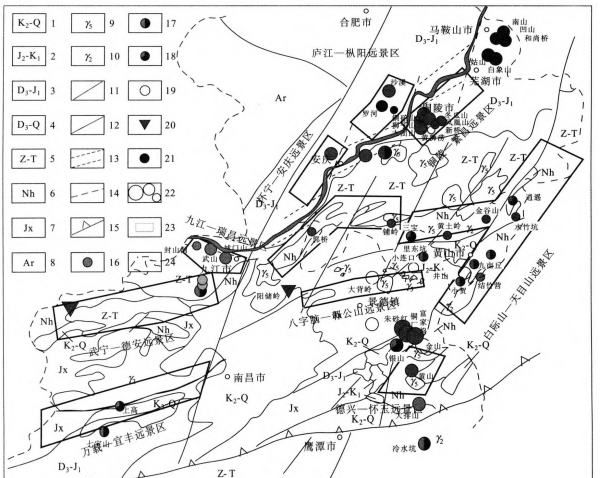
Figure 1 10 prospecting areas in adjacent areas of Anhui and Jiangxi
3.2 Wuning-De'an Prospective Area
Main minerals: copper, lead, zinc, tin, antimony and gold
Main type: Zhang Shiba/Zeng Jialong type layer control stack modification.
It is located near the intersection and turning point of east-west and north-south structures. The Pengshan dome structure has Neoproterozoic Nanhua-Sinian volcanic rock-sandstone-moraine-carbonate rock ore-bearing structures, and the deep part is the hidden Yanshanian granite basement. Research on the Anhui-Jiangxi project preliminarily believes that this area has two major mineralization systems, namely the Neoproterozoic volcanic eruptive sedimentary mineralization system and the Yanshan-Hishan magmatic hydrothermal mineralization system (including superimposed mineralization).
The mineralization geological conditions in the Pengshan area are particularly superior and the comprehensive information on mineral resources is rich. Using the Zhangshiba layer-controlled lead-zinc mining area as a known model unit, model comparison and estimation were carried out. The total lead-zinc resources are more than 10 million tons, and the copper resources are 1 million. tons, and the total amount of silver resources is more than 10,000 tons. Prospecting prospect with very large ore deposits. It is recommended to conduct a "comprehensive information prospecting model and total mineral resource prediction research" and on this basis, use the Pengshan area as the general battlefield, compare the model units as sub-war areas, use new technologies and new methods, construct drilling, and comprehensively carry out prospecting Check and evaluate work.
3.3 Huaining-Anqing Scenic Area
Main minerals: copper, iron, gold (sulfur).
Main deposit types: Yueshan type skarn type and volcanic rock type.
In the surrounding area of the Yueshan rock mass, the ore-bearing strata are mainly dolomitic marls of the Carboniferous Huanglong Formation and Chuanshan Formation or the Permian and Triassic systems. The intersection of EW-trending faults and fold uplifts or depressions is where magma activity and Favorable structure for mineralization. A number of sulfur, iron, gold and copper deposits, represented by the Yueshan Copper Mine and the Caiguashan-Bailing Gold Mine, have been discovered. The Duxiu Mountain anticline in the west is a fold area dominated by Paleozoic strata. There are low slow magnetic anomalies, gravity anomalies, low resistivity anomalies and geochemical anomalies. The preliminary explanation of the anomalies is that there are hidden rock masses in the depths, and the local emplacement at the top is relatively high. , is conducive to mineralization, among which the Huxing Mountain and Yinzhu Mountain areas have the background to search for "Dongguashan-type copper deposits" and areas with the potential to search for large-medium skarn-type copper deposits. The "Wutong Formation" is a place where iron caps are commonly seen on the floor. However, due to the relatively low level of research and work, its mineralization conditions can be compared with the mineralization characteristics of Tongling, southeastern Hubei and other places, especially in the middle layers of the Carboniferous ore-bearing strata. The control of skarn-type copper deposits has not yet been broken through. The Huaining volcanic rock basin in the western section is one of more than ten basins in the middle and lower reaches of the Yangtze River metallogenic belt. The two volcanic rock basins adjacent to this area, Luzong and Ningwu in the east, contain rich copper, iron, gold, Sulfur and other minerals, but the level of work in this area is low and no major breakthroughs have been made. This area focuses on breaking through the skarn-type copper deposits in Huxingshan Yinzhushan and other places, and opens up prospecting work in new areas such as the Huaining volcanic basin, achieving new breakthroughs in regional prospecting.
3.4 Tongling-Fanchang Scenic Area
Main minerals: copper, iron, gold, sulfur, lead and zinc.
Main deposit types: Shizishan skarn type and strata-controlled superimposition (Trinity) type.
The intersection of the NE-trending fold structure composed of the Silurian-Triassic system and the nearly east-west or nearly north-south faults in this area is often a favorable location for the formation of magmatic rocks, ore fields and deposits. The Middle Carboniferous, Permian and Triassic dolomitic limestones are the main ore-bearing layers. The late Jurassic-Cretaceous intermediate-acid magma activity was frequent, and the related iron, copper, and gold minerals were abundant. There are dozens of large, medium, and small deposits that have been proven, such as Tongguan Mountain, Lion Mountain, Phoenix Mountain, Large-scale copper deposits such as Dongguashan, and large-scale sulfur-gold-copper-silver deposits such as Xinqiao, Mashan, and Huangshi Laoshan.
In recent years, geological survey work has discovered large-scale copper-lead-zinc mineralization zones in Baimuling-Yeshan, Suishan and other places. It is worth conducting in-depth verification work. The first is to strengthen deep detection; the second is to expand to the periphery of Nanling-Fanchang. The Institute of Mineral Resources of the Chinese Academy of Geological Sciences has carried out regional alteration-fluid mapping in recent years and established a new mineralization model of 4 mineralization systems and 7 subsystems, looking for "trinity-type" deposits in the periphery of Tongling, Fanchang and Nanling, and open Improved vision and prospecting ideas.
3.5 Lujiang-Zongyang volcanic rock basin and surrounding prospect areas
Main minerals: iron, copper and sulfur.
Main deposit types: volcanic-porphyry type (iron ore) and porphyry type (copper ore).
The Luzong volcanic rock basin is located in Lujiang and Songyang counties, spreading in a northeast direction. The west side is cut by the Tanlu fault and is in the shape of a large semicircle. The volcanic rock basin is superimposed on the compound syncline foundation composed of Silurian-Triassic and Early Middle Jurassic strata, and is an inherited volcanic rock basin. From early to late, the volcanic rock system is divided into four major cycles: Longmenyuan (coarseous), Zhuanqiao (coarse), Shuangmiao (coarse-potassic), and Fushan (coarse).
In and around the Luzong volcanic basin, in addition to the large-scale iron-sulfur deposits discovered in Luohe and Dabaozhuang, there are also the large-scale porphyry copper deposit in Shaxi, the large-scale iron-rich Longqiao mine, and the medium-sized Yueshan lead-zinc deposit. There are many areas with the same mineralization conditions and geophysical and geochemical anomalies around the volcanic basin. For example, there are many gravity and magnetic geophysical anomalies in Huangtun Huangnihe-Panshiling, the northern edge of the basin, and Huigong Yutan Gaodian, the southwestern part of the basin. It has the potential to discover mineral deposits such as "Longqiao iron deposits", "porphyry iron deposits" and "porphyry copper deposits". Strengthen comprehensive analysis and drilling verification. It is very likely to achieve major breakthrough prospecting results.
3.6 Pengze-Shitai-Guichi Scenic Area
Main minerals: copper and gold.
Main types: sandstone type (copper-silver mine), altered rock type (gold mine), porphyry type (copper mine).
This area is located at the southeastern edge of the southward-protruding reflection arc of the Huaiyang mountain-shaped structure. The structural pattern of the Hukou section is similar to that of De'an Pengshan. It has Nanhua-Sinian sandstone-moraine-carbonate rock and late Paleozoic clastic rock-carbonate rock mineral-bearing structures. A small amount of Yanshanian rock mass is found on the surface, and gravity and magnetic geophysical anomalies infer the existence of three hidden rock batholiths. Eye-catching copper geochemical anomalies are distributed along regional structural lines. 22 copper-gold deposits (sites) have been discovered in the Nanhua System in Pengze County, including Guoqiao, Huashan, Dabijian, and Lishan. The mineral belt extends intermittently for about 50 kilometers. It has great prospecting prospects.
The Guichi metallogenic area is roughly consistent with the foreland reverse fold-thrust belt. The discovered deposits are mainly skarn-type and hydrothermal-type copper deposits, followed by porphyry-type copper-gold mineralization and hydrothermal-type tungsten, molybdenum, Lead and zinc mineralization. In particular, the porphyry belt produced in this area is also one of the porphyry belts symmetrically distributed on both sides of the Jiangnan Uplift. Copper-gold polymetallic mineralization is common. In recent years, exploration work has successively discovered Paodaoling in Guichi County. The porphyry gold mine, Mashi, Tongshanpai-Jilaishan porphyry copper mine all reach medium to small scale. This shows that this area has great potential for finding porphyry copper-gold deposits.
3.7 Baiji Mountain-Tianmu Mountain Scenic Area
Main minerals: copper, lead, zinc, gold, silver, tungsten, tin, and molybdenum.
Main deposit types: volcanic eruptive sedimentary type, porphyry type, trinity type, and ductile shear zone type.
This area is located on the northeastern edge of the Jiuling-Zhanggongshan terrane, with the Northeast Jiangxi-Ningguo fault running NE across the central part. It has mineral-bearing structures such as the Mesoproterozoic volcanic rock system, the Qingbaikou system marine-continental bimodal volcanic rock system, and the Nanhua-Sinian-Cambrian moraine-carbonate rock-carbonaceous shale. There are Tunxi and Qingliangshan Mesozoic volcanic rock basins and many Yanshanian intrusive rock bodies. Eye-catching geochemical anomalies are spread in clusters, and many gravity and magnetic anomalies are included among them. Medium-sized copper-gold-tungsten-lead-zinc deposits such as Sanbao, Huangtuling, Qiaochuan, Jixia, Xiaoyao, Xiwukou, Dawjian, and Xiaohe have been discovered. As long as investment and systematic work can be increased, several large-scale mineral deposits will surely be found in areas with such a unique and excellent mineralization environment.
According to the work in recent years, the target areas that can carry out census and pre-survey include Hongcunkou-Censhan, Huangtuling-Jiepai-Fangwukou, Jiumuqiu-Yuanfang, Jiezhuying-Julin, Changchunwu, Qianwu Mu fields, torreya pits, big dock tips, and snow.
3.8 Bazi Nao—Zhanggong Mountain Scenic Area
Main types of minerals: mainly tin-tungsten ore, and also gold mine.
Main types of attack: rock types (tin deposits) and structurally altered rock types related to ductile-brittle shear zones (gold deposits).
This area is located in the core of the Zhanggongshan massif. It has gold-tin-tungsten formations in the Mesoproterozoic Shuangqiaoshan Group turbidites, small Yanshanian intrusive rock bodies - S-type granite porphyries spread in series, and dense chemical Detect the abnormality and fit it. Maopengdian medium-sized tin mine, Jinjiawu large-scale gold mine, Dabeiwu medium-sized gold mine, Qingshuxia medium-sized tungsten mine and a number of mineral sites have been discovered. With strengthened census and pre-examination, prospecting prospects will become increasingly clear. The key work areas for investigation and evaluation include Bankengwu-Maopengdian Tin Mine and Jialu Gold Mine.
3.9 Dexing-Huaiyu Mountain Scenic Area
Main minerals: copper, gold, silver, niobium, tantalum, lead and zinc.
Main deposit types: porphyry type, ductile shear zone type, stratigraphic stack modification type, and altered granite type.
This area is located in the collision and docking zone of the Jiangnan terrane and the Qiantang terrane - the northeastern Jiangxi collision mixed rock zone and its side. The Huaiyu massif is sandwiched in the triangle area composed of the northeastern Jiangxi deep fault and the Le'anjiang deep fault. It has Mesoproterozoic Zhangcun Group volcanic turbidites, Nanhua-Sinian moraine-carbonate rocks and late Paleozoic mineral-bearing structures. Magmatic activity was intense during the Yanshan period. Due to the unique geological background and tectonic magmatic conditions, two major mineralization series have been developed: dynamic metamorphic mineralization and volcanic-porphyry mineralization.
The deposits that have been explored and developed mainly include the extra-large Tongchang copper (gold) mine, the large-scale Fujiawu copper-molybdenum mine, the large-scale Yinshan copper polymetallic mine, the extra-large Jinshan gold mine, the medium-large Xijiang gold deposit, and the Geyuan extra-large Tantalum niobium ore, etc. The proven copper reserves are 10 million tons, accounting for 7.5% of the country's total reserves. It is a famous gold and copper mineralization concentration area in the country. The depth of copper-gold mineralization in the Tongchang-Cinnabar Red area and the Xiyuanling area in the northwest is greater than 1,200m. While strengthening the summary of mineralization zoning rules, we will carry out new geophysical survey methods, increase drilling depth, and search for new hidden ore bodies. There is still hope for a substantial increase in reserves. In addition, similar layered lead-zinc deposits (such as Banzhukeng) in the Nanhua-Sinian system have low workability and good prospecting prospects (Yang Minggui, 2004).
31,000 years—Yifeng Scenic Area
Main minerals: copper, gold, lead and zinc.
Main deposit types: porphyry type, strata-controlled stack modification type, and ductile shear zone type.
This area is located at the contact point between the Jiuling terrane and the Ping-Le combination zone. The NE-trending Yifeng-Nanchang deep fault is a regional rock-controlling ore-controlling structure. It has Mesoproterozoic Yifeng Formation volcanic turbidite and late Paleozoic carbonate mineral-bearing structures. Invasive activities during the Yanshan period were intense. Copper-gold geochemical anomalies are mainly distributed along the volcanic rocks of the Yifeng Formation, and are combined with several gravity and magnetic anomalies. A medium-sized copper-iron-lead-zinc deposit controlled by skarn in front of Gao'an Village has been discovered, as well as Luocheng, Yaxi, Pengyuan and other copper deposits related to the Mesoproterozoic serpentine porphyry system. This area has the metallogenic background conditions for the Dexing porphyry copper deposit. Work in depth and you may have a major breakthrough.
Acknowledgments: This article is a rough understanding of the results of the research project under the "Mineral Resources Evaluation Project in Adjacent Areas of Anhui and Jiangxi". The work has received strong support from the leaders of China Geological Survey, Nanjing Institute of Geology and Mineral Resources, as well as the Geological Survey Institute of Jiangxi Province and Anhui Province, metallurgy and other geological exploration units, as well as the majority of geological prospecting workers. Here, I would like to express my deep gratitude!
references
[1] Wang Jian. Neoproterozoic rift basin evolution in South China. Beijing: Geology Press, 2000
[2] Yang Minggui, Wang Faning, Zeng Yong, et al. Metal mineralization geology in northern Jiangxi. Beijing: China Dadi Publishing House, 2004
[3] Zhai Yusheng, Yao Shuzhen, Cui Bin, et al. Series of mineralization studies. Beijing: China University of Geosciences Press, 1996
[4] Zhai Yusheng et al. Regional mineralization. Beijing: Geological Press, 1999
[5] Pan Guitang, Xu Qiang, Hou Zengqian, et al. Mineralization system and resource evaluation of the multi-island arc orogeny process in Sanjiang, Southwest China. Beijing: Geology Press, 2003
[6] Ji Shaoxin, Wang Wenbin, Xing Wenchen, et al. Northwest Jiangxi Copper Mine. Beijing: Geological Press, 1990
[7] Wang Daohua, Fu Dexin, Wu Luxiu. Basic characteristics and mineralization rules of copper, gold, iron and sulfur deposits in the middle and lower reaches of the Yangtze River. Beijing: Geological Press, 1987
[8] Bao Jiabao, Tang Shuqing, Yu Zhiqing. Geology of Jiangxi Copper Mines. Nanchang: Jiangxi Science and Technology Press, 2002
[9] Hua Renmin, Chen Peirong, Zhang Wenlan, et al. On the third large-scale mineralization in the Mesozoic in South China. Mineral Deposit Geology, 2005, 24 (2)
[10] Chang Yinfo, Liu Xiangpei, Wu Yanchang. Iron-copper metallogenic belt in the middle and lower reaches of the Yangtze River. Beijing: Geology Press, 1991
[11] Zhu Xun, Huang Chongke, Rui Zongyao, et al. Dexing Porphyry Copper Mine. Beijing: Geology Press, 1983
[12] Chen Yuchuan et al. Prospective evaluation of mineral resources in China's main metallogenic areas. Beijing: Geology Press, 1999
[13] Chen Yuchuan, Li Zhaonai, Mu Ruishen, etc. Gold deposits in China and their mineralization rules. Beijing: Geology Press, 2001
[14] He Jurui, Wang Aiguo, Rui Xingjian, et al. Preliminary study on the mineralization of the eastern section of the Qin-Hangzhou combination zone. See: Jiangsu Provincial Geological Society. Earth Science and Social Sustainable Development. Wuhan: China University of Geosciences Press, 2005
[15] Wu Ganguo, Zhang Da, Peng Runmin, et al. Research on the temporal evolution of mineral deposit formation in the southeast coastal metallogenic belt. Geoscience Frontiers, 2004, 11(1): 237~247
[16] He Jurui, Wang Aiguo,Rui Xingjian.Ore-Bearing Formations of the Precambrian in South China and Their Prospects. Acta Petrol. Sinica, 2004,78(2):375~379
Mineralization and Ore Searching Perspective in Anhui-Jiangxi Provinces
he J u Rui, Wang AI Guo, Zen G Yong, R UI xing key
(Nanjing Institute of Geology and Mineral Resources, Nanjing 210016)
Abstract: There are four systems of mineralization in Wan-gan area: Mesoproterozoic benthal volcanic system; Neoproterozoic benthal hydrothermal sediment system; Late Paleozoic hydrothermal sediment (upper cumulation) system and Mesozoic volcanic-intrusive magma system. Recently, we have got a lot of new outputs and developed nine ore strips. Synthetical information show that ten perspective districts of ore-prospecting can be considered as the emphases in the next ore-perambulation.
Key words: Wan’ g an Area; Mineralization system; Perspective of ore-prospecting district
The above is all about Pan Guitang's geology, trench arc basin system, and Pan Guitang's related content. I hope it can help you.